The South China Sea is one of the largest semi-enclosed marginal seas in the world. It covers an area of 3.5106 km2 with an average depth of 1350m although its maximum depth can reach 5000 m. The main basin of the SCS extends from about 22oN along the coasts of southern China to about the equator along the Sunda Shelf north of Borneo and from about 105oE along the coast of the Indo-Chinese Peninsula to 120oE along the westerncoast of the Philippine islands. Thus, almost the entire sea lies within the tropical zone. The SEATS station is located in the tropical northern SCS at 18oN, 116oE in about 3800m of water.(Wong et al., 2002)
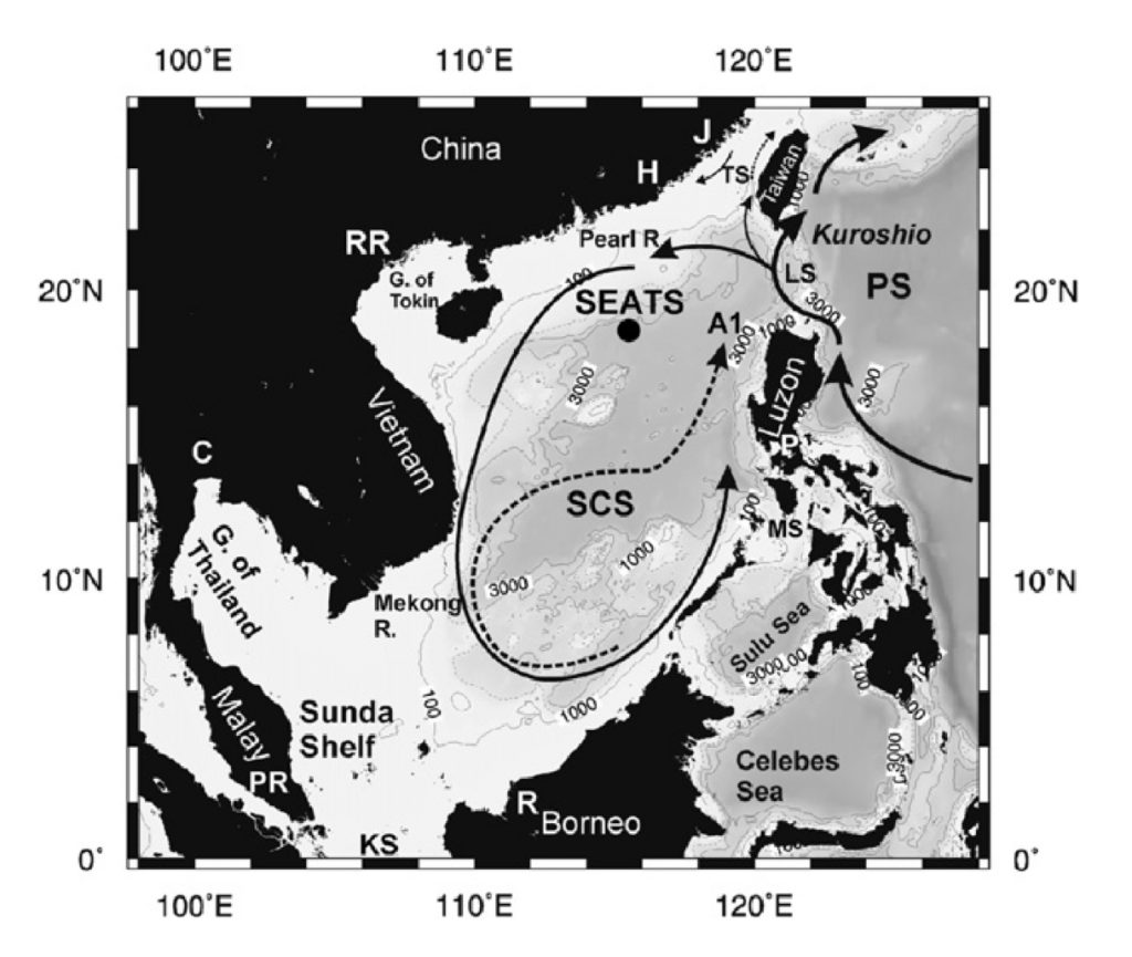
The study area. The solid line in the South China Sea (SCS) represents the basin wide cyclonic gyre in the winter. The dashed line indicates the eastward jet off the coast of Vietnam and the anticylonic gyre over the southern half of the sea during the summer. The Kuroshio and its intrusions into the northern South China Sea are also shown schematically around the Luzon Strait. KS—Karimata Strait; LS—Luzon Strait; MS—Mindoro Strait; PS—Philippine Sea; TS—Taiwan Strait. The locations where the major rivers reach the SCS are also shown: C—Chao Phraya; H—Hanjiang; J—Jiulongjiang; P—Pasig River; PR— Pahang River; R—Rajang River; RR—Red River.(George T.F et al., 2007)