南海,世界最大的邊緣海(Marginal Sea)之一,位置介於南緯3度至北緯22度、東經105度至東經120度。南海外型為東北-西南走向的半封閉海盆,形狀近似菱形,從四周呈階梯狀向中部加深,面積為3.5×10⁶ km2,平均深度為1350m,最深可達5567m(陳,2001)。陸域界線南起印度尼西亞的南蘇門達臘(Sumatera)和加里曼丹(Kalimantan)之間,北以台灣南端與廣東南澳島的連線為界,西接中南半島及馬來半島東岸,東以台灣、菲律賓群島至巴拉望島的連線為界。海域界線,南端與西南端分別與巽他陸棚(Sunda Shelf)及泰國灣(Gulf of Thailand)相接,東側隔著巴拉望島與蘇祿海(Sulu Sea)比鄰,東北側與北側分別於與呂宋海峽、巴士海峽及台灣海峽相接。
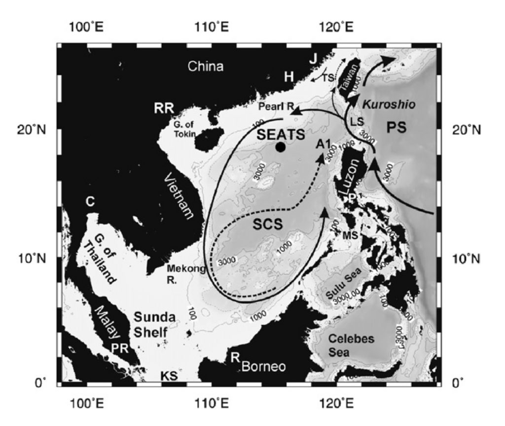
The study area. The solid line in the South China Sea (SCS) represents the basin wide cyclonic gyre in the winter. The dashed line indicates the eastward jet off the coast of Vietnam and the anticylonic gyre over the southern half of the sea during the summer. The Kuroshio and its intrusions into the northern South China Sea are also shown schematically around the Luzon Strait. KS—Karimata Strait; LS—Luzon Strait; MS—Mindoro Strait; PS—Philippine Sea; TS—Taiwan Strait. The locations where the major rivers reach the SCS are also shown: C—Chao Phraya; H—Hanjiang; J—Jiulongjiang; P—Pasig River; PR— Pahang River; R—Rajang River; RR—Red River.(George T.F et al., 2007)
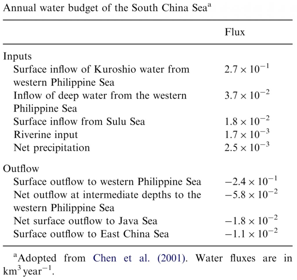
南海為邊緣海,其水文特性相較於其他時間序列之海域,環境更顯複雜。南海西南部之海水交換主要來源為印度洋海水經由麻六甲海峽Strait of Malacca及巽他海峽Sunda Strait的海水流通;南部主要通道為卡里瑪塔( Karimata) 及格拉薩海峽( Gelasa Straits)與爪哇海(Java Sea)進行海水交換,東部蘇祿海(Sulu Sea)海水經由明多羅海峽(Mindoro Strait)與南海海水互動,而東北部呂宋海峽則是南海與西太平洋之海水最主要海水交換的通道,當海水進入巴士海峽後,部分會進入台灣海峽,再流入東海海域。